Proud to share that the IBA team at University of Louisiana at Lafayette earned 1st place at the North American Semi
Undergraduate Certificate in Geographic Information Systems
Tue, 01/24/2023 - 8:38am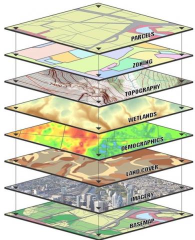
We have a new undergraduate certificate in GIS!
This undergraduate certificate curriculum will teach Environmental Science, Geology and Geography students about mapping technologies in order to prepare them for a future career in GIS/GISP certification.
Students will gain applied knowledge in:
- theory + methodologies behind mapping technologies & spatial thinking
- gain necessary skills to use GIS for basic database management & analysis & data visualization of vector data, raster data, topologies, & remote sensing
- independently develop a research question, find data, & analyze spatial relationships
- experience working with professionals in the field
Find out more in the UL Lafayette Catalog
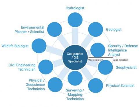
Careers